 |
|
|
|
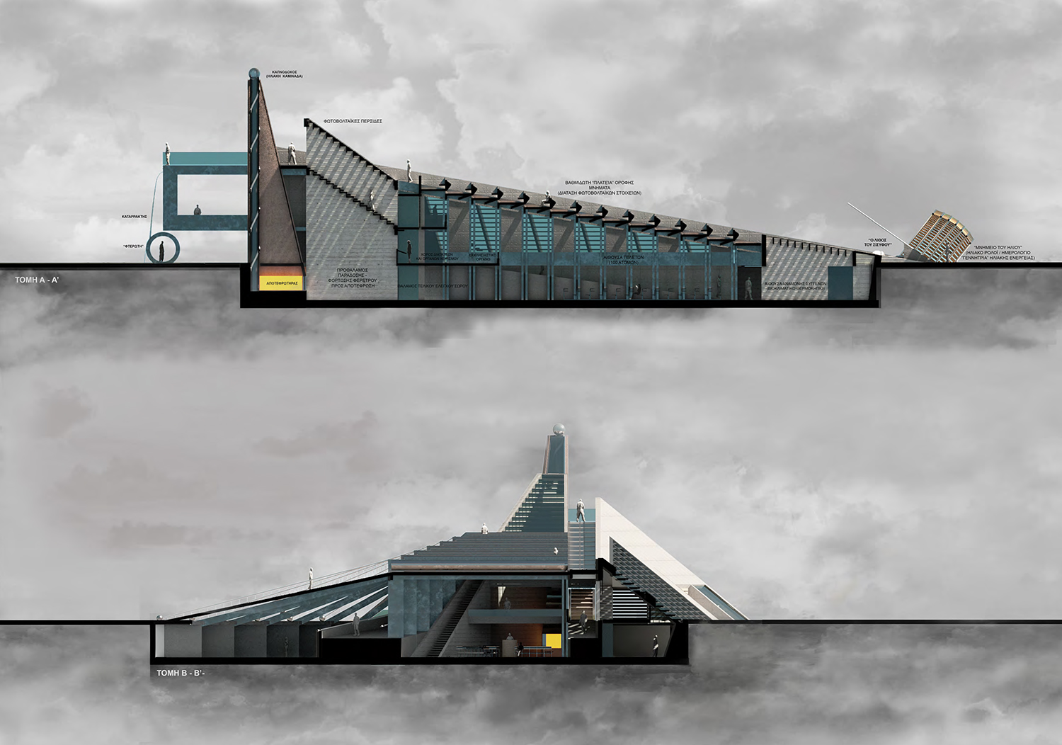
Proposal description: Musical staircase-stand The "modelphone"
|
     |
 |
|
|
|
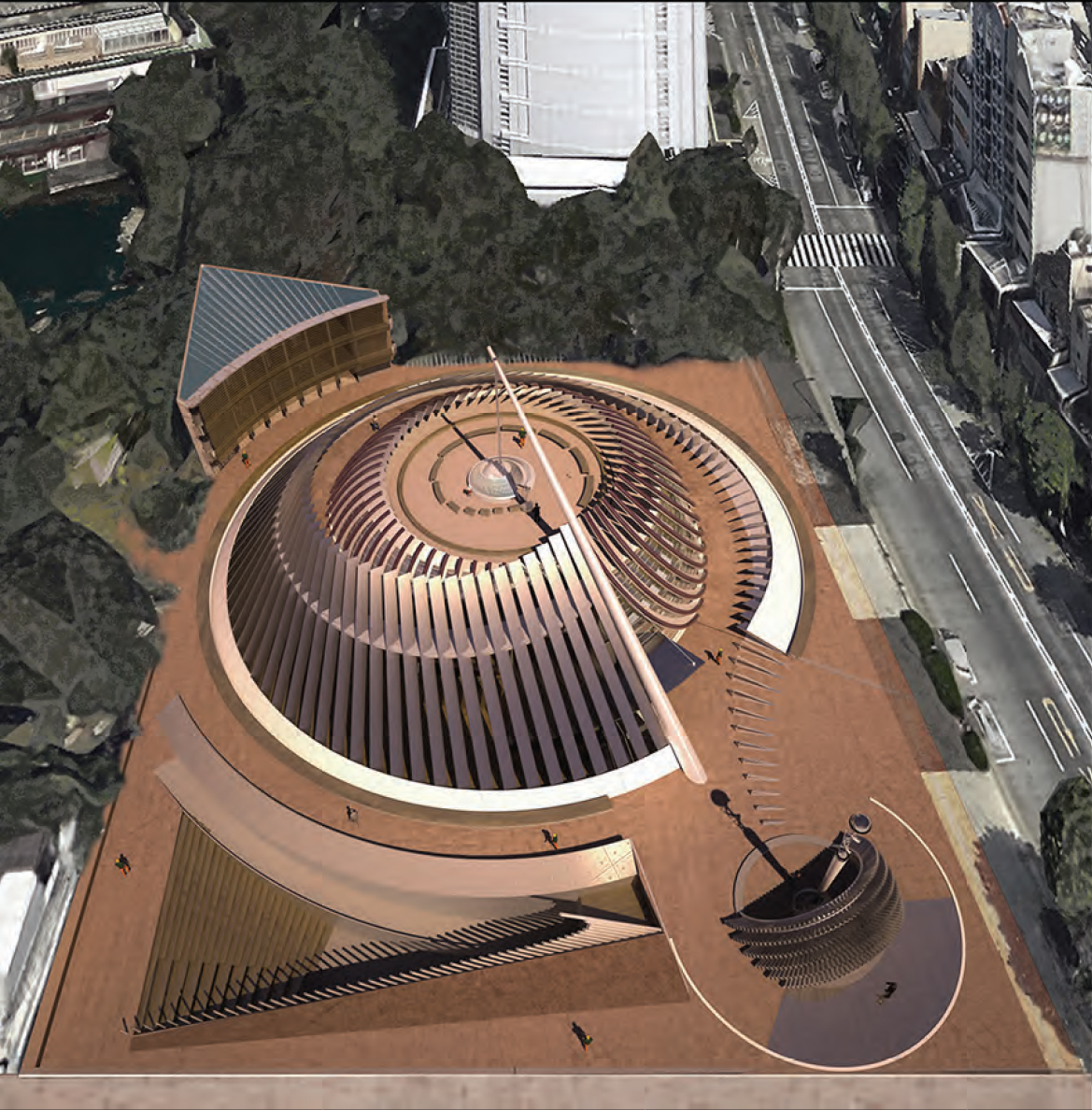
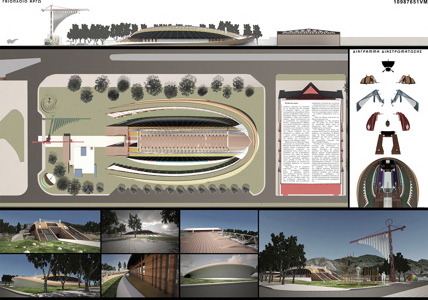
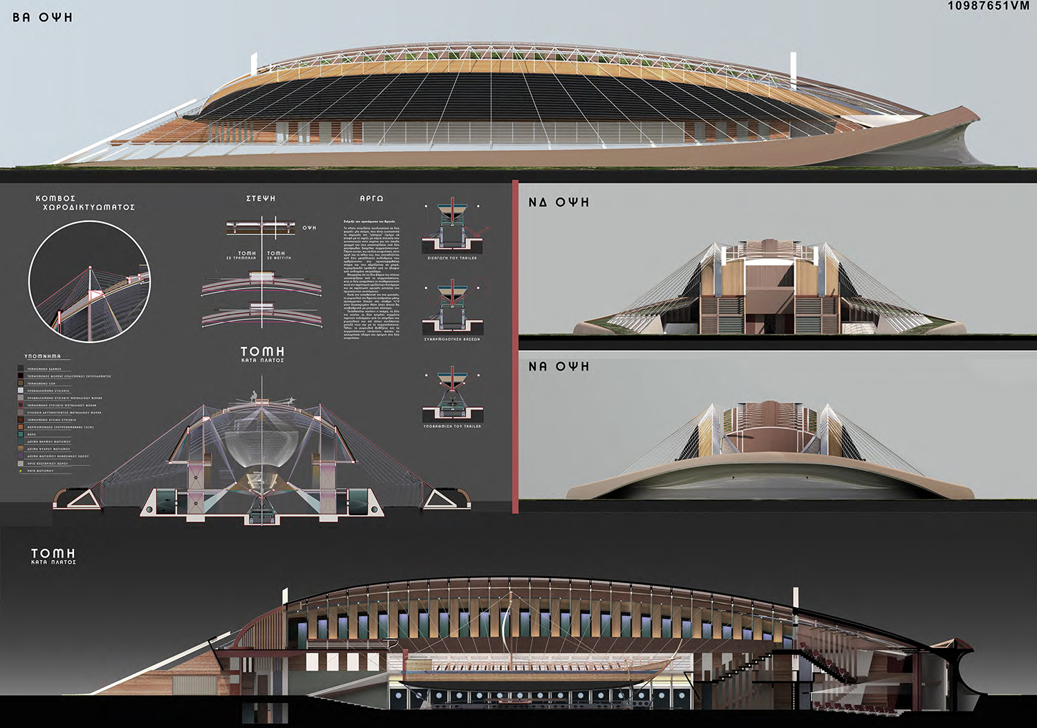
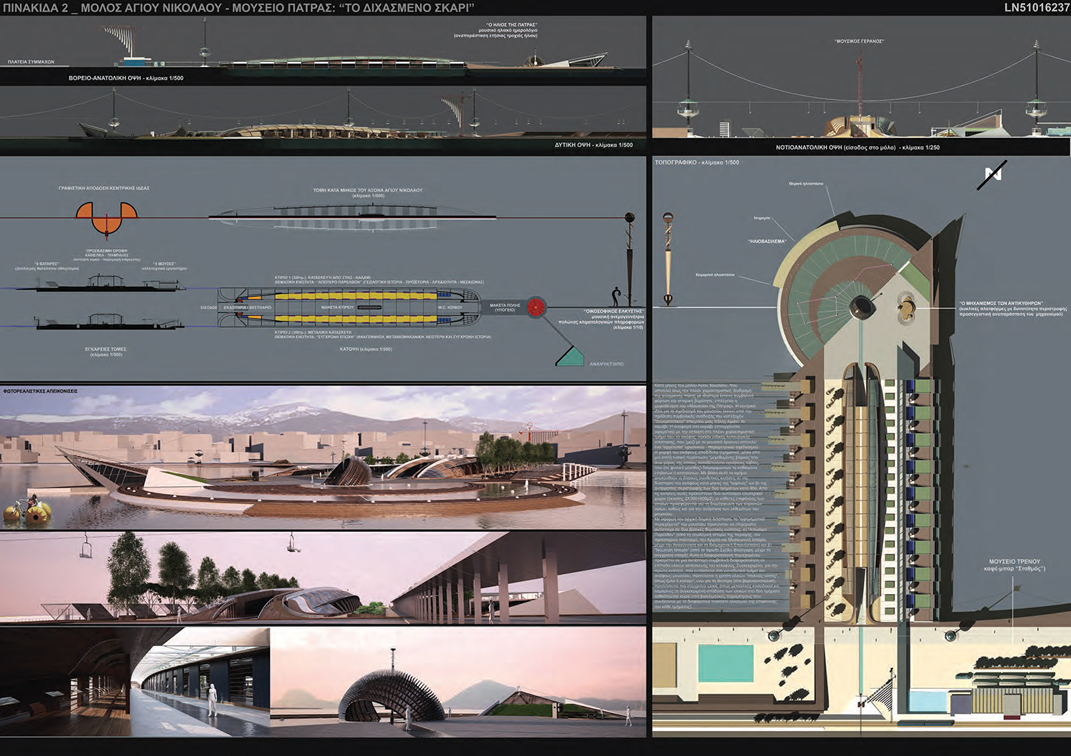
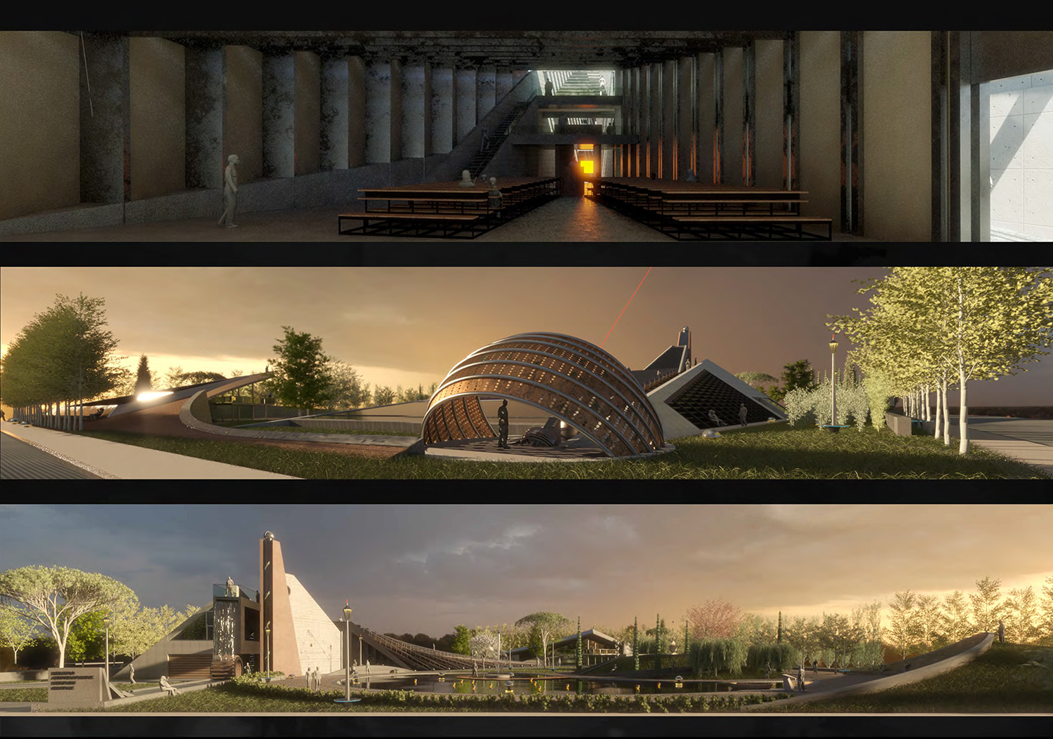
Proposal Summary: The ship - exhibit is placed in between these two main volumes (in a way that gives the impression of the passage through the "Sympligades Petras"). The selection of the individual spatial units that make up the overall structure of the museum space is based on the general breakdown of the ship into four main sections: |
   |
 |
|
Collaborators: Vassilis Vasiliadis, Iulia Iliadi, Panagiota Stylianidou, Konstantinos Christodoulidis |
|
Summary |
    |
 |
|
|
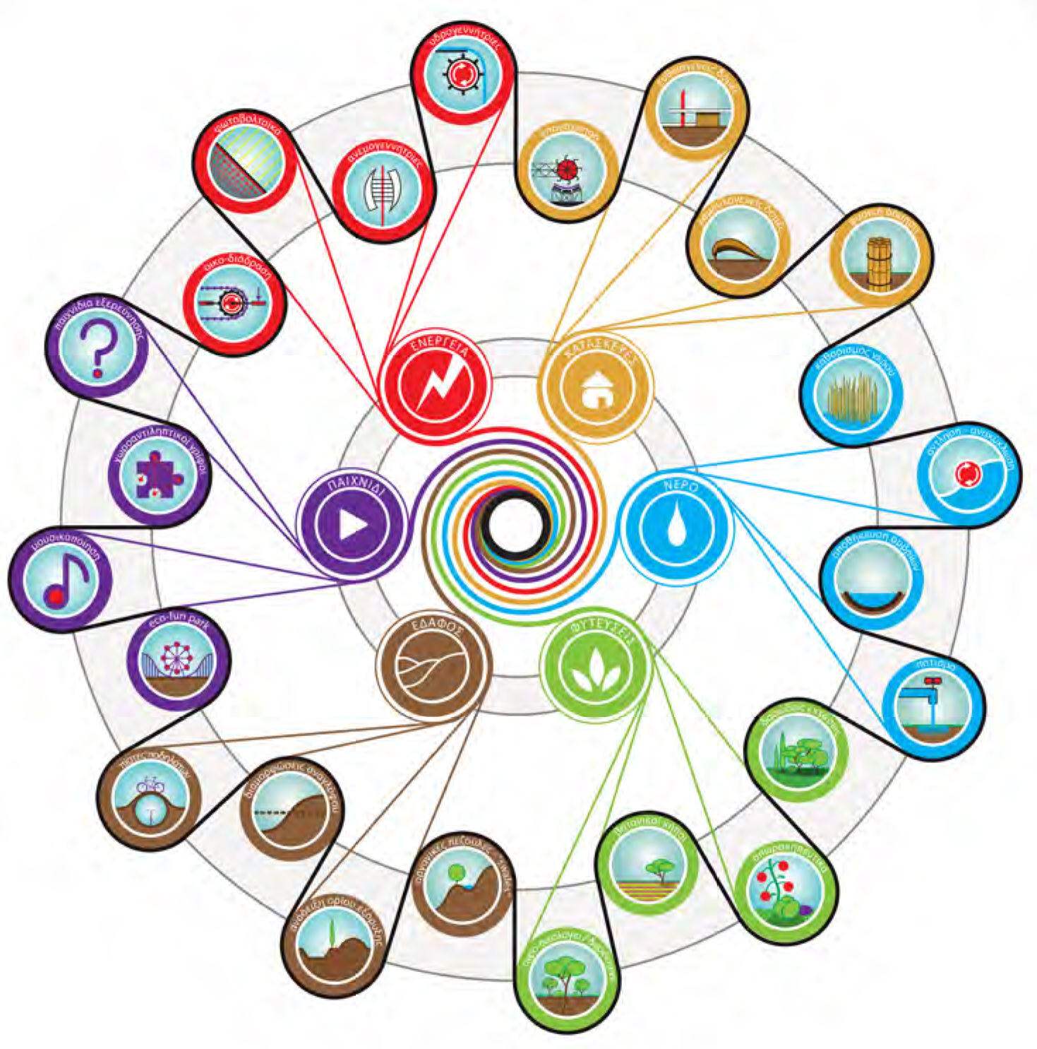
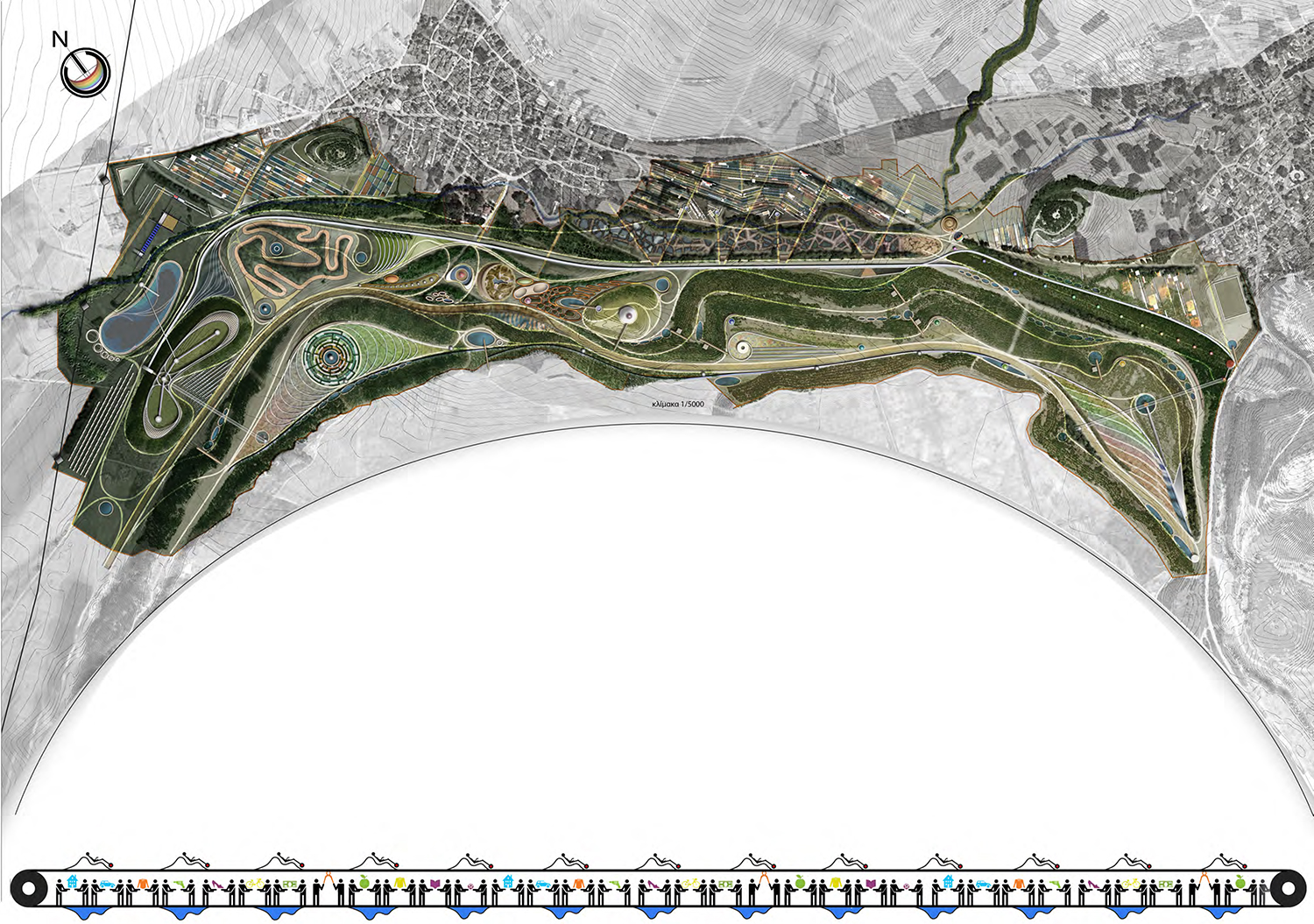
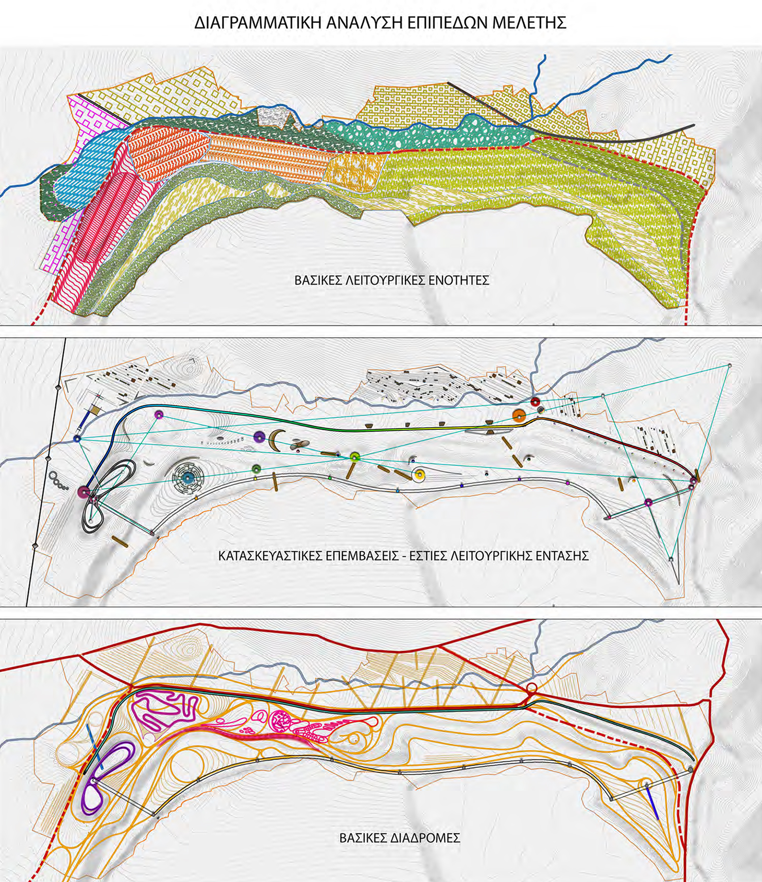
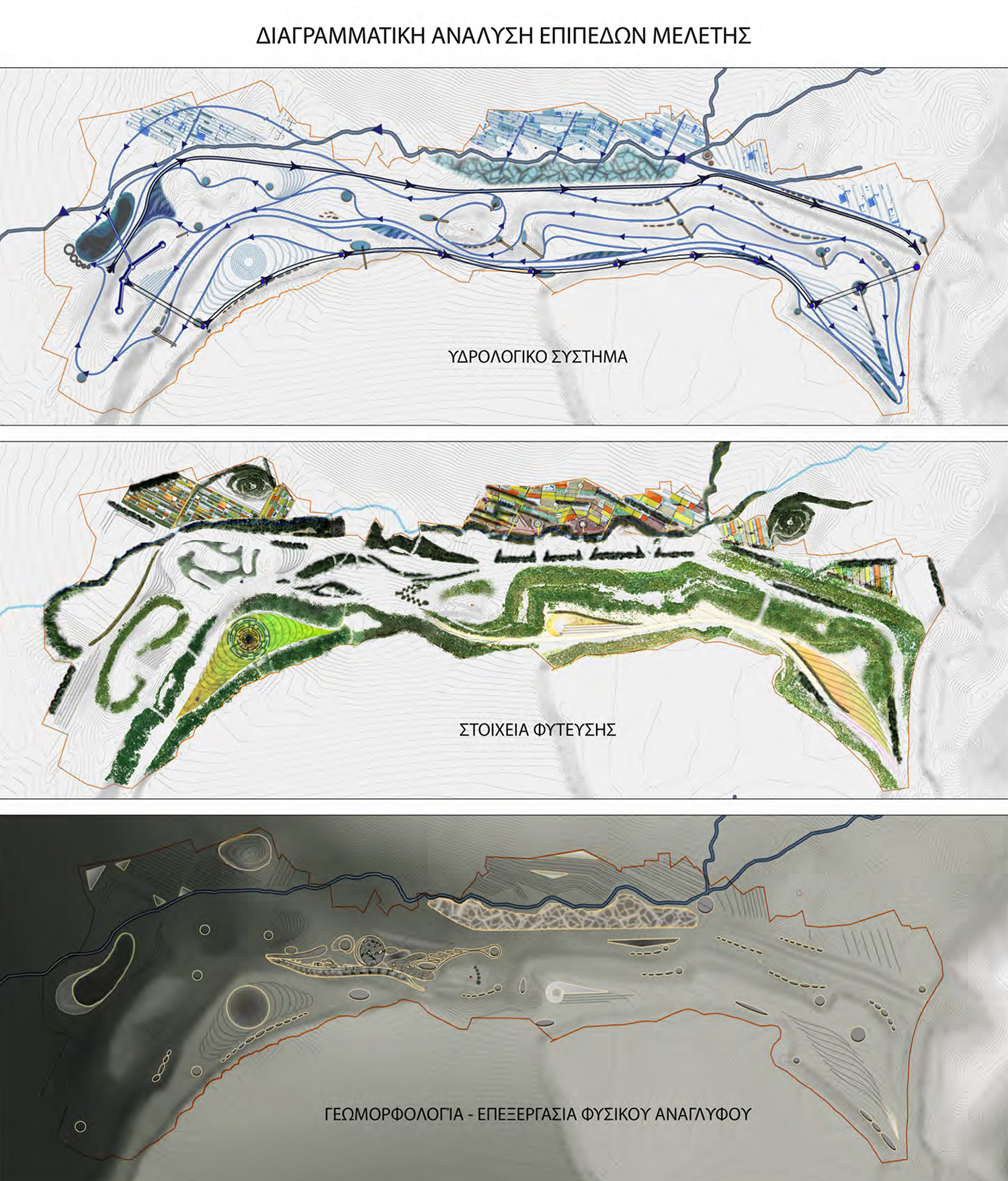
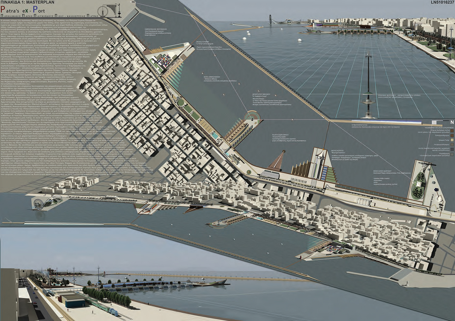
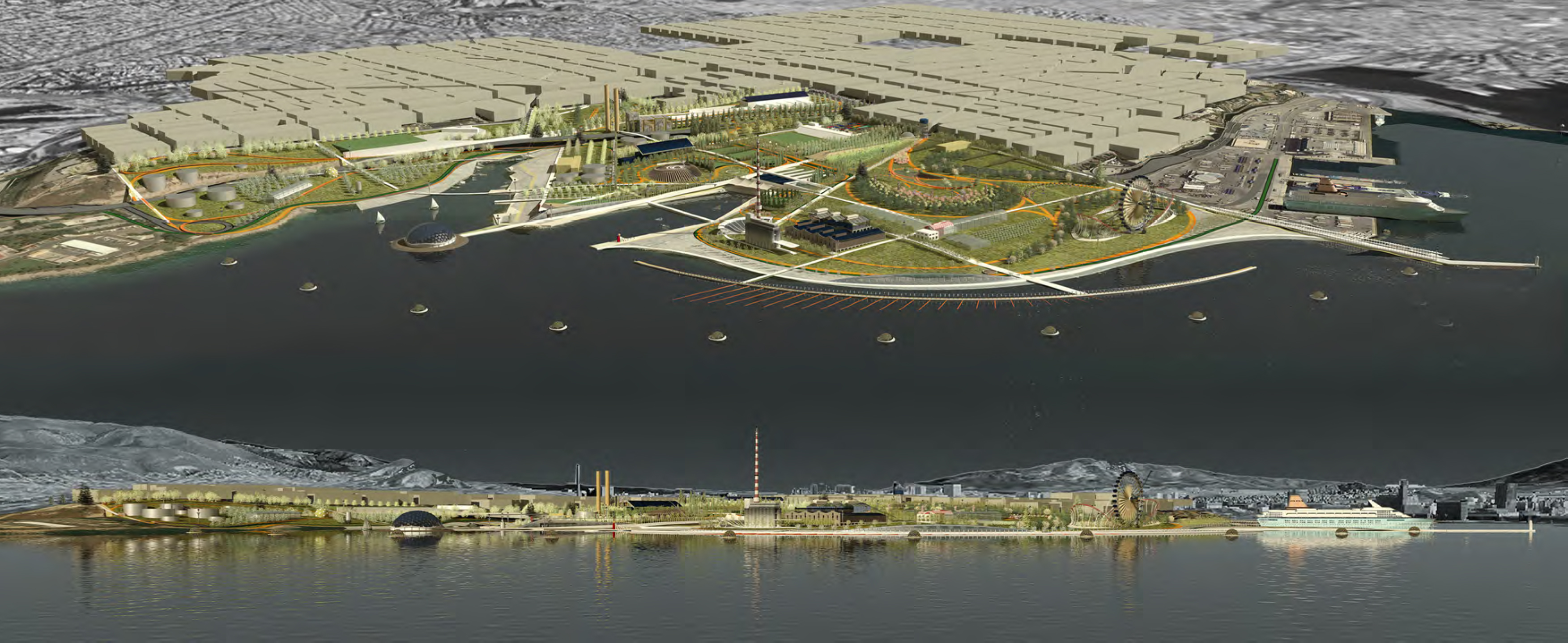
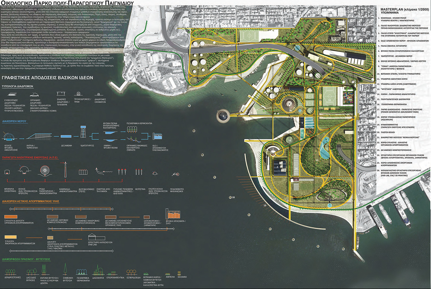
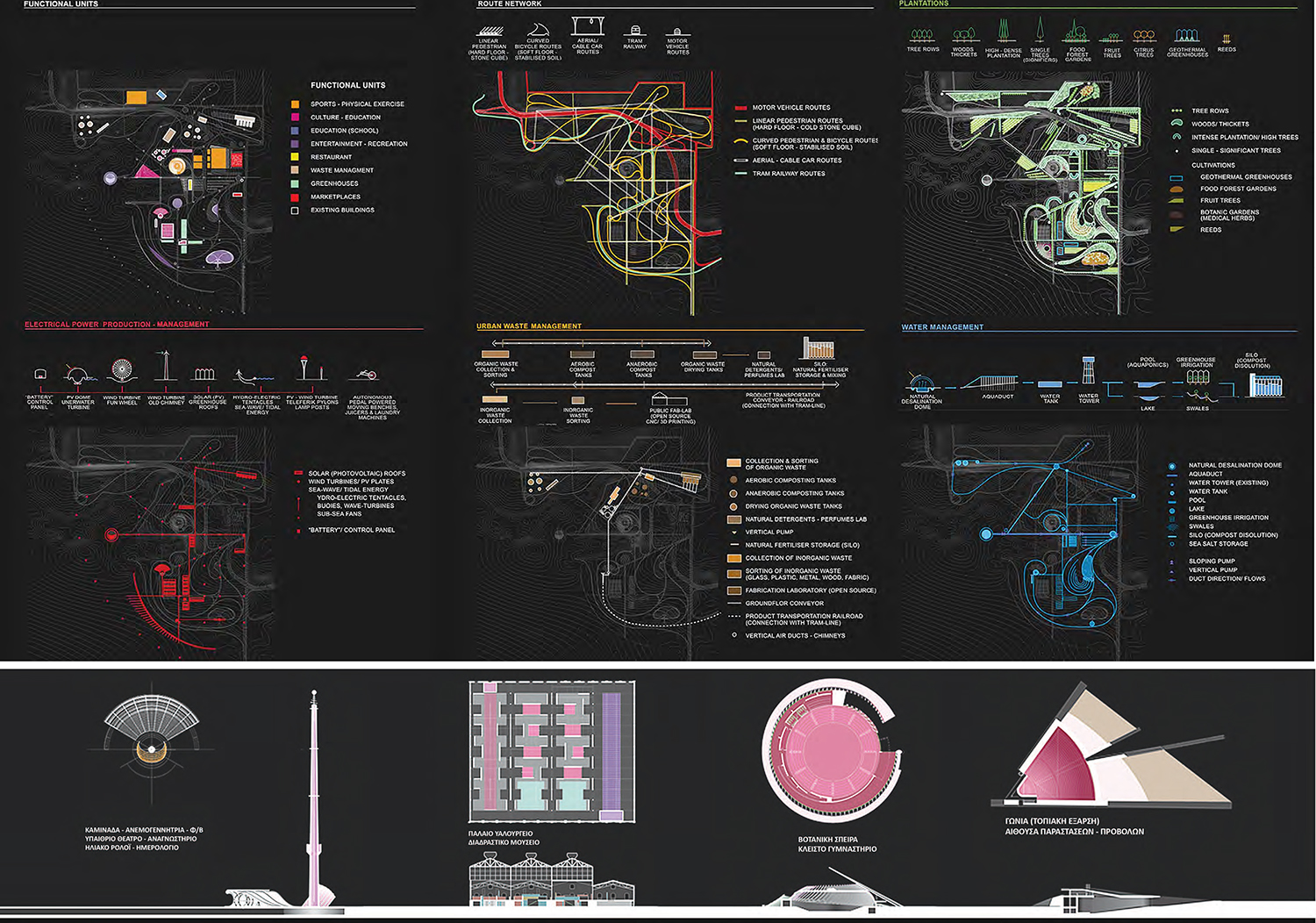
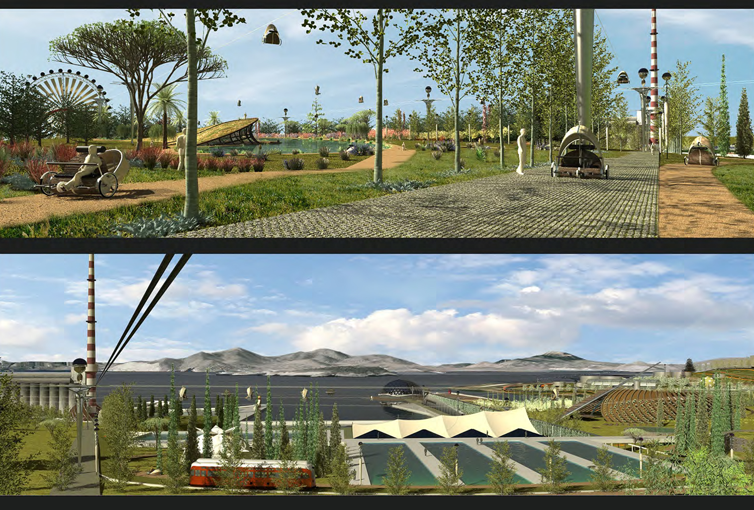
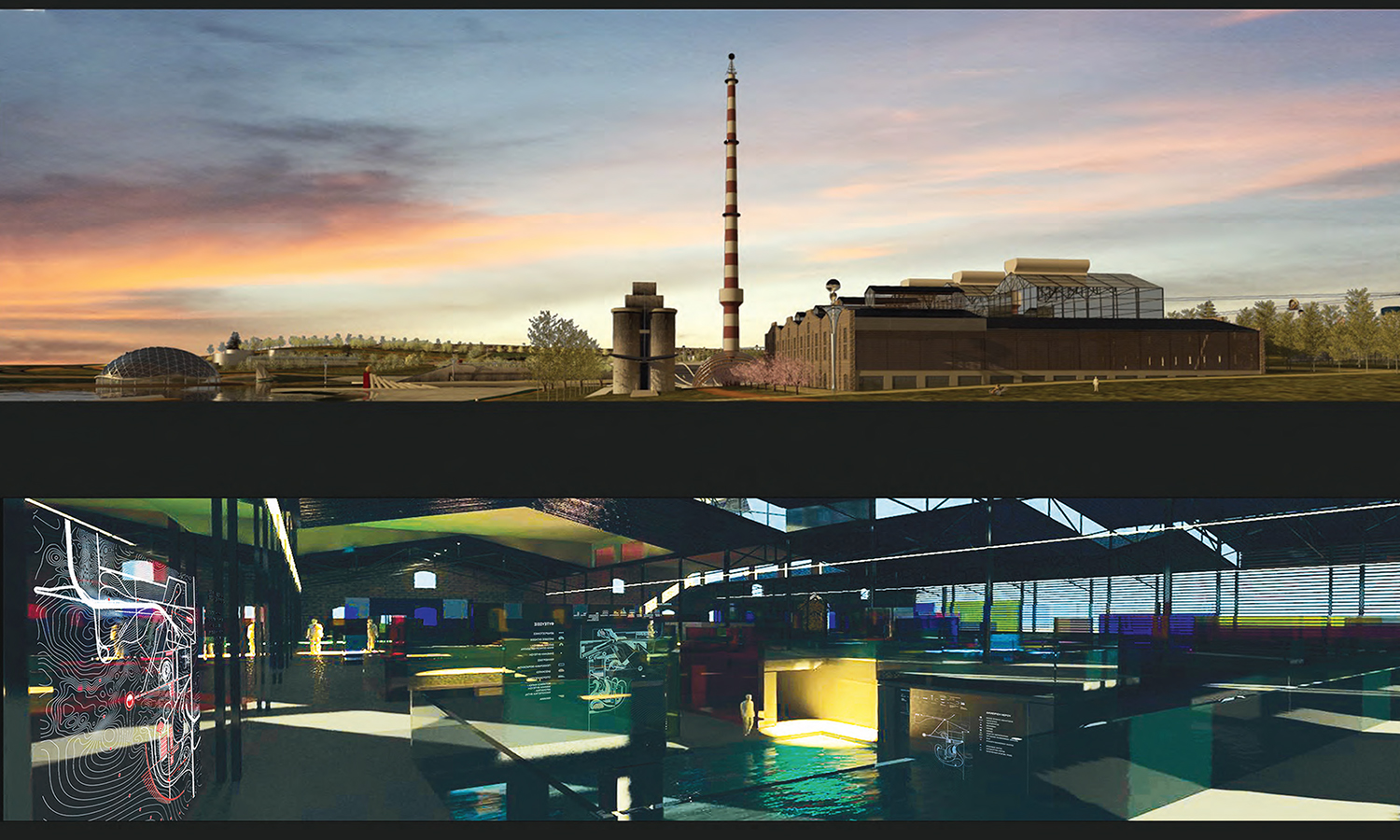
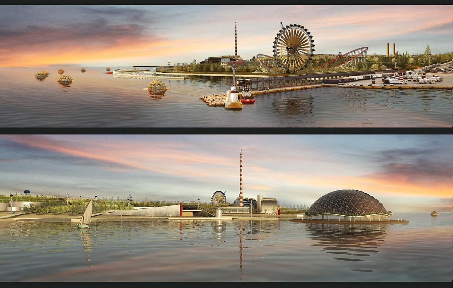
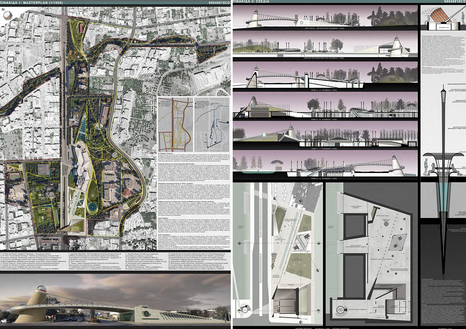
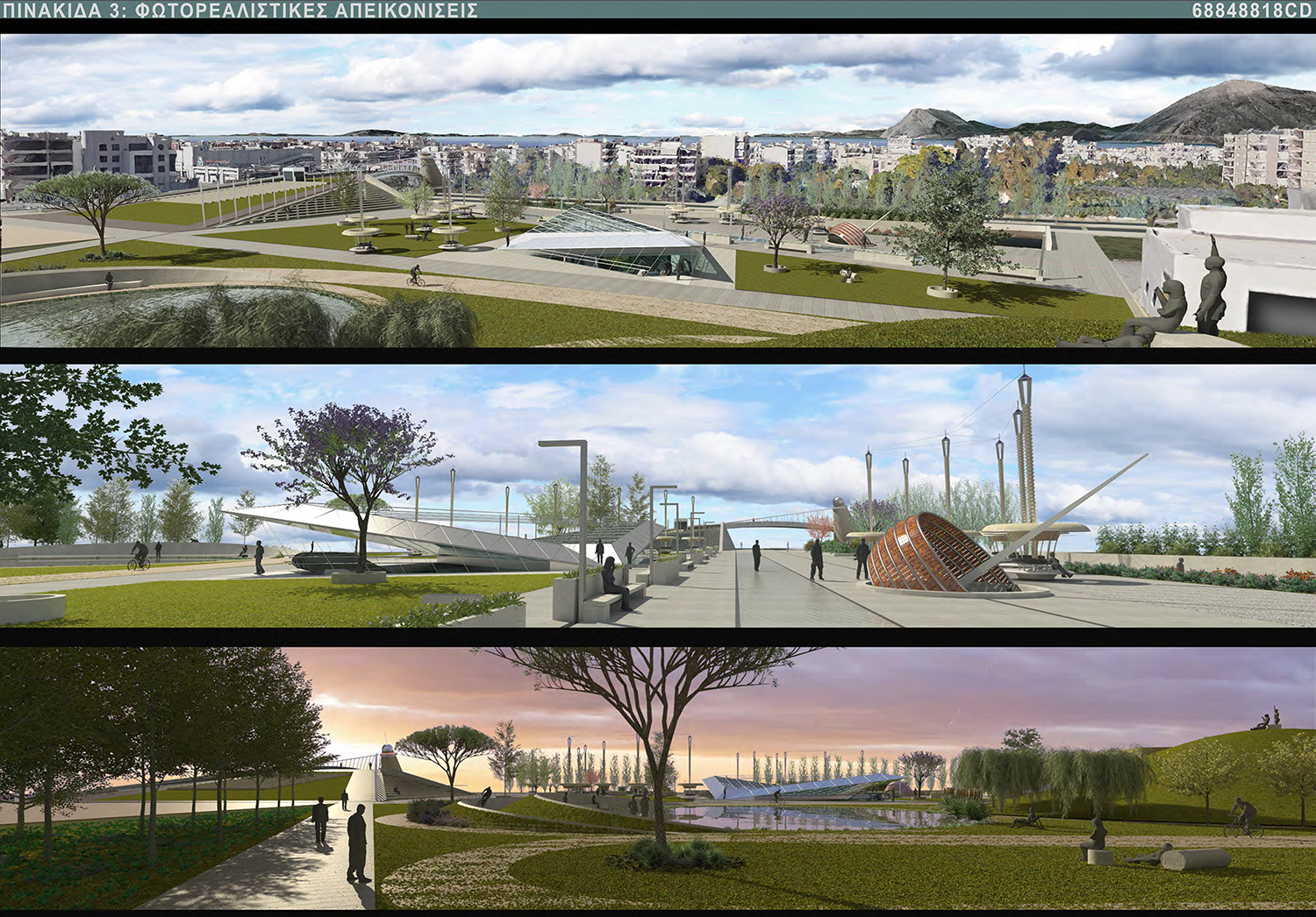
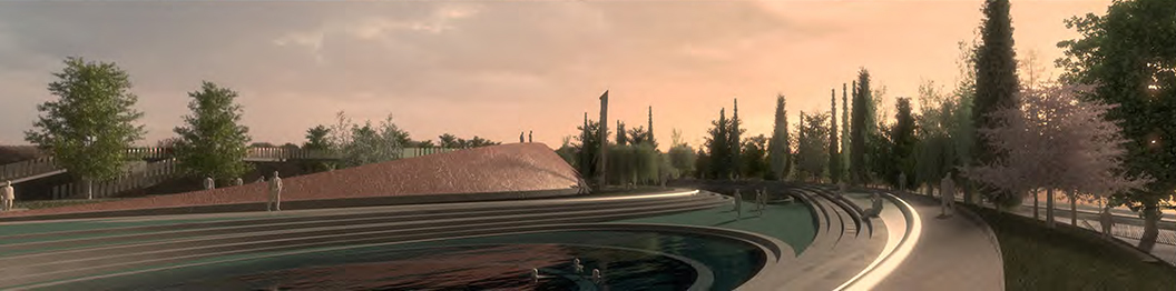
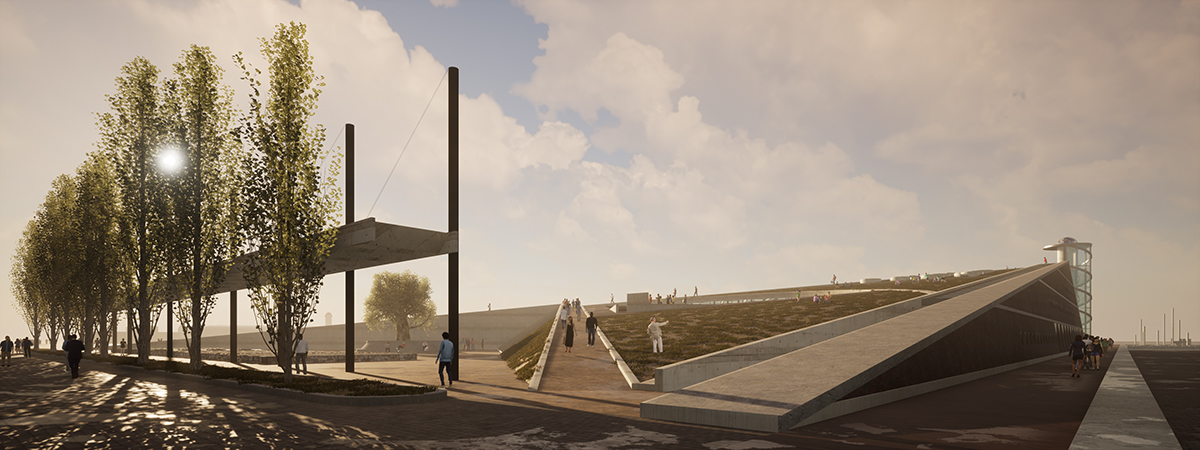
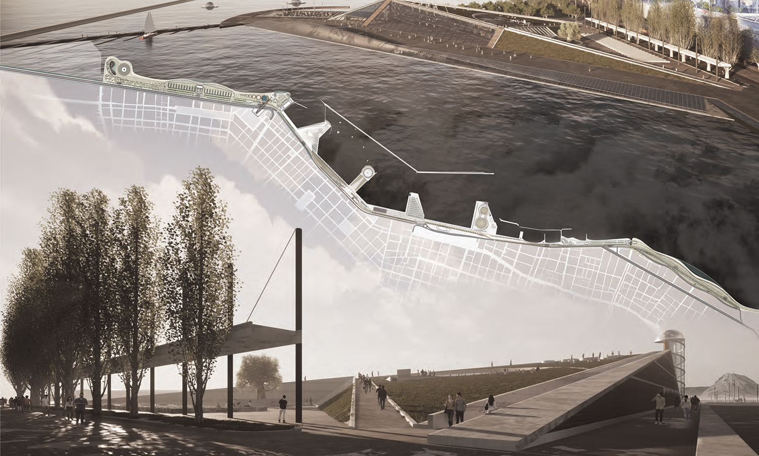
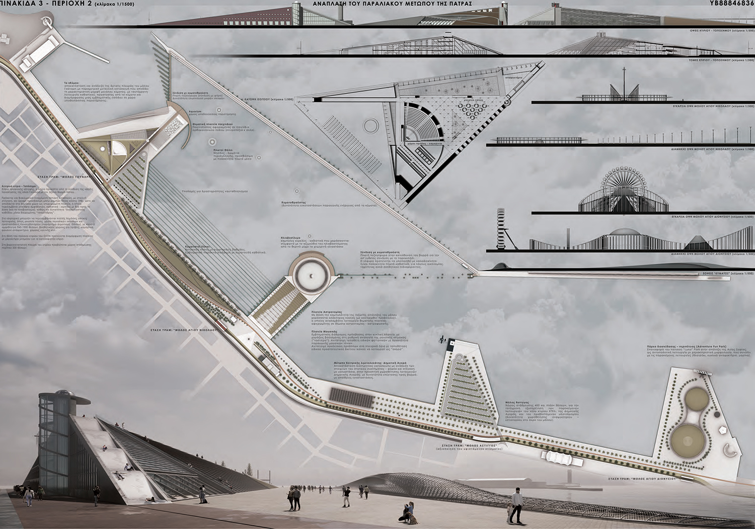
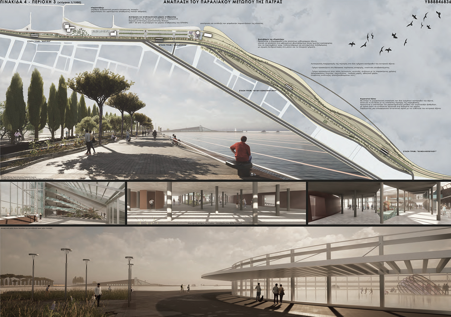
| Summary The general objective of the proposal concerns the transformation of the area of the Old Port of Patras into an intensively active part of the public space of the city, in the perspective of its wider appropriation, first and foremost by the local community, alongside a clear desire to render a supra-local pole of attraction, of international scope. The interventions aim at the functional enrichment, the environmental-bioclimatic restoration, the aesthetic upgrading and the necessary financial return. In the first phase, emphasis is placed on the extensive areas of the front deemed suitable for mild, economically-technically feasible and accessible rehabilitation and functional activation interventions, with modern ecological materials of low construction and maintenance requirements, as well as with the maximum possible utilization of existing equipment. In the next phase, emphasis is placed on the development of architectures with a stronger functional and symbolic presence, suitable for morphological and constructional refinements. Based on the above, the design attempts to render a harmonious-opposite relationship between various geometric forms, structured and spaced in such a way so as to respond satisfactorily to the different functional requests posed by each case. These requests, which compose a complex functional and morphological-structural "biodiversity", yielding an attractive urban "ecosystem", governed by multiplicity, adaptability and flexibility - resilience. With these data, alongside the requirement to maintain a port function for "cruise" ships (in the northern and central port basin), we proposed the formation of a network of multiple - mutually complementary urban functions, which can include activities such as: a) Culture (Patras/Train Museum, Concert Hall), b) Education (Urban Workshops, Municipal Conservatory), c) Commerce (Central Food Market, stores), d) Residence-Accommodation (student residences, hotel), e) Energy and Food Production (urban forest gardens, "hydroponic" crops - Aquaponics) and of course f) Recreation and Entertainment (refreshment bars, cafe-restaurants, themed squares, amusement parks, etc.). |
   |
 |
|
|
|
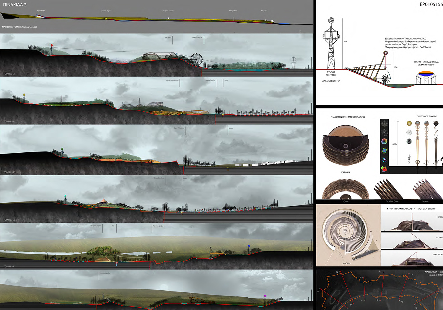
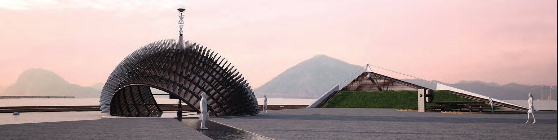
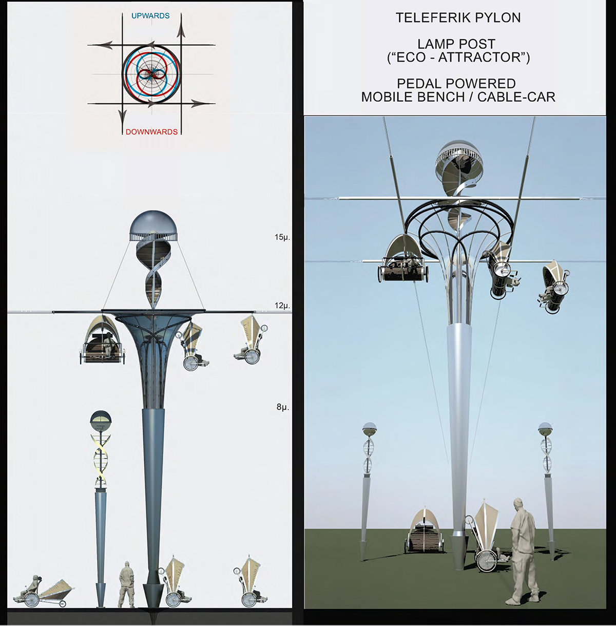
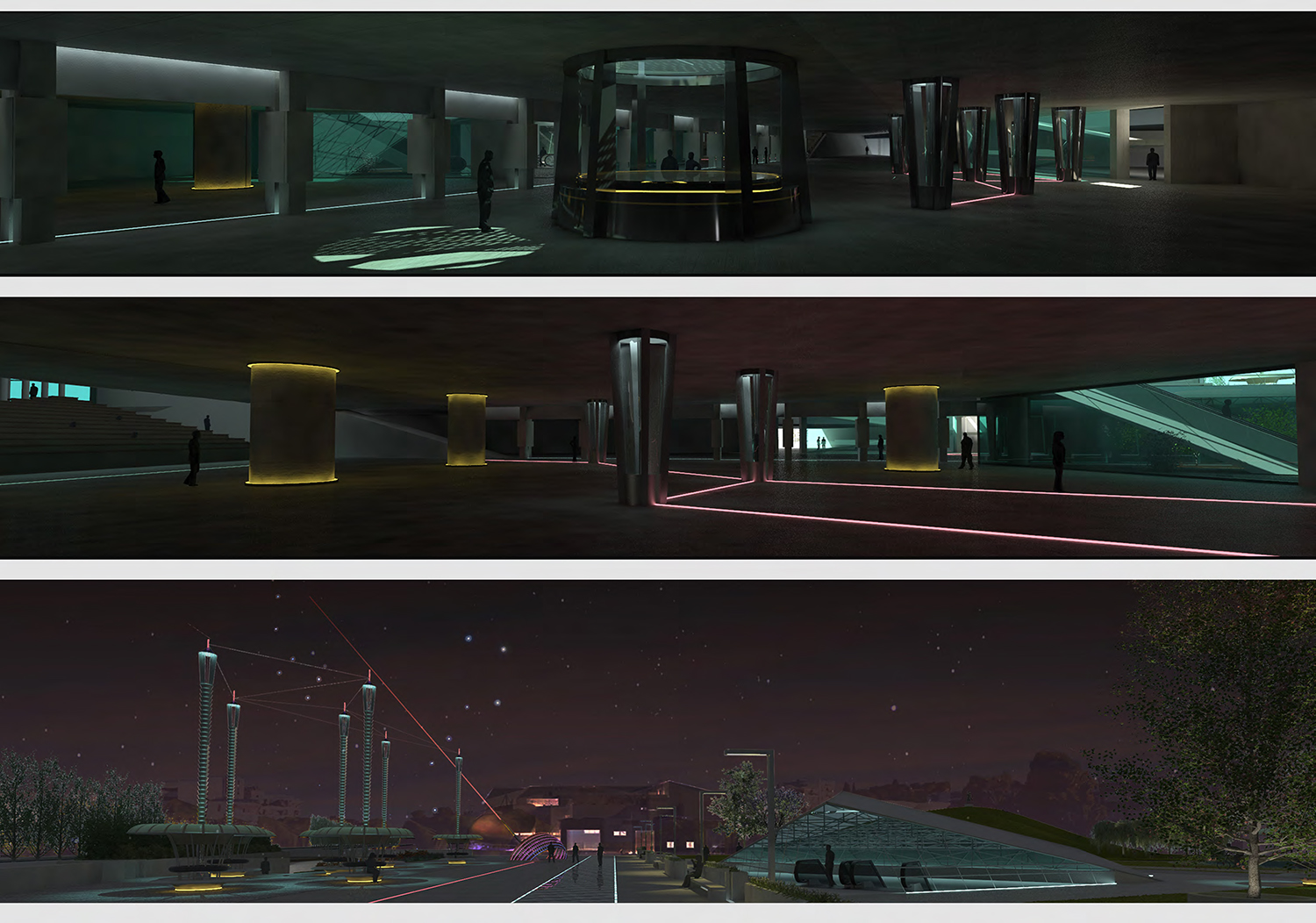
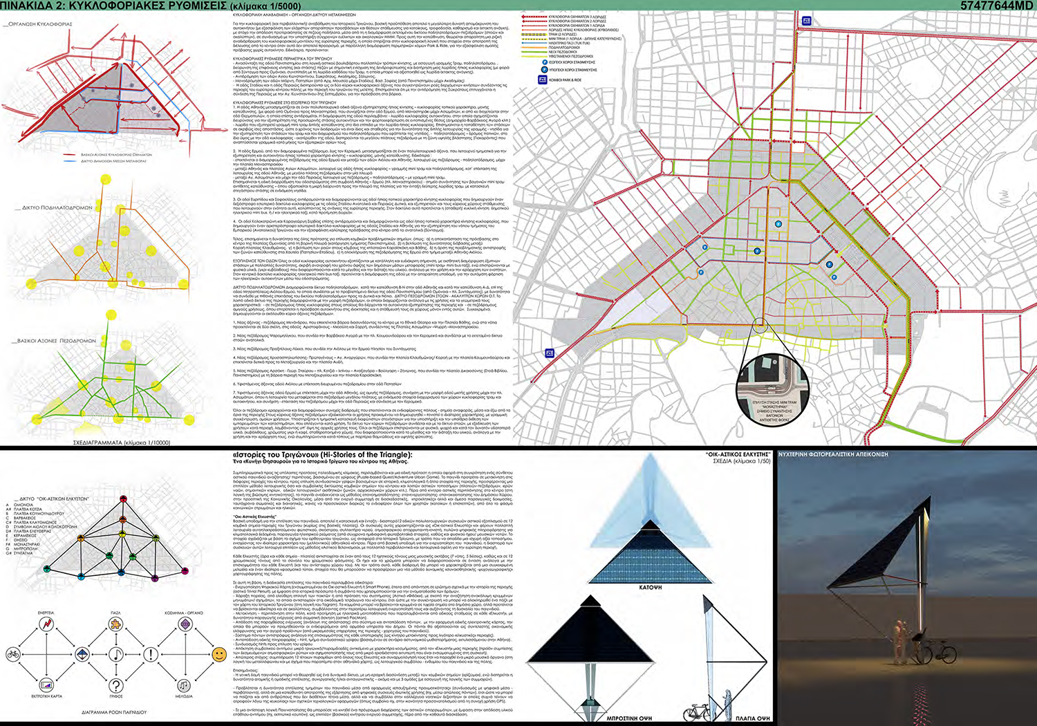
Summary On the side, it is worth mentioning our attempt to introduce a complex method of “smart” eco-mobility through special, pedal powered mobile benches that can turn into cable-cars (teleferik), following a network of linear aerial routes. The pylons – nodes of the whole structure (along with the special lamp posts of the park) are designed to function also as rainwater collectors, bearing vertical (double-spiral) wind-turbines and PV cells [Image 9]. |
      |
 |
|
|
|
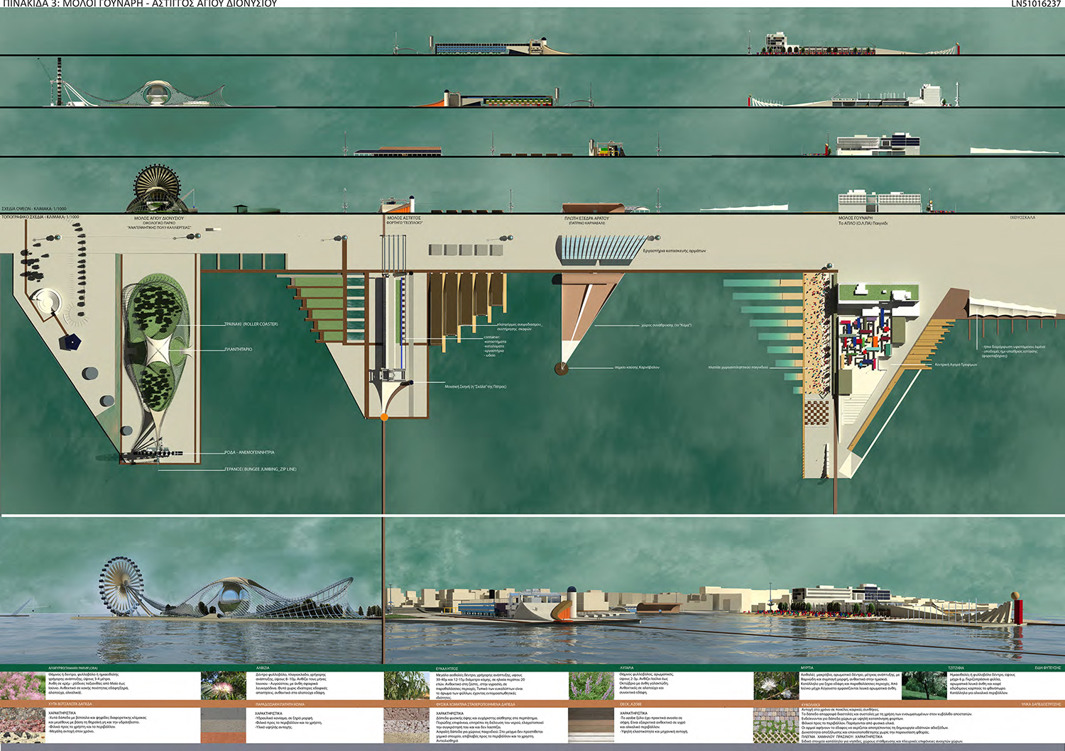
Summary It is worth pointing out that, although in general in the area we do not recognize any serious traffic problem, there is an issue related to the difficulty-impossibility of accessing the Museum for vehicles coming from the stream to Patras (from Athens). This problem is proposed to be solved in the gentlest possible way, i.e. by introducing an additional ground level crossing (with a traffic light) at the point in front of the Museum entrance, in combination with configurations at street level that allow direct vehicle access ( island remodeling). |
   |
 |
|
|
|
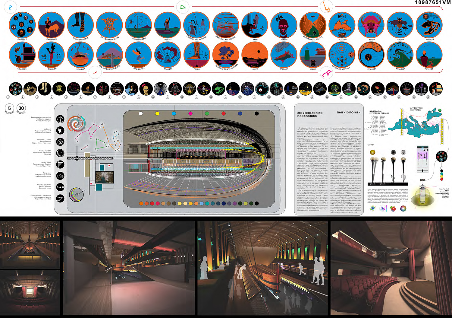
Main idea
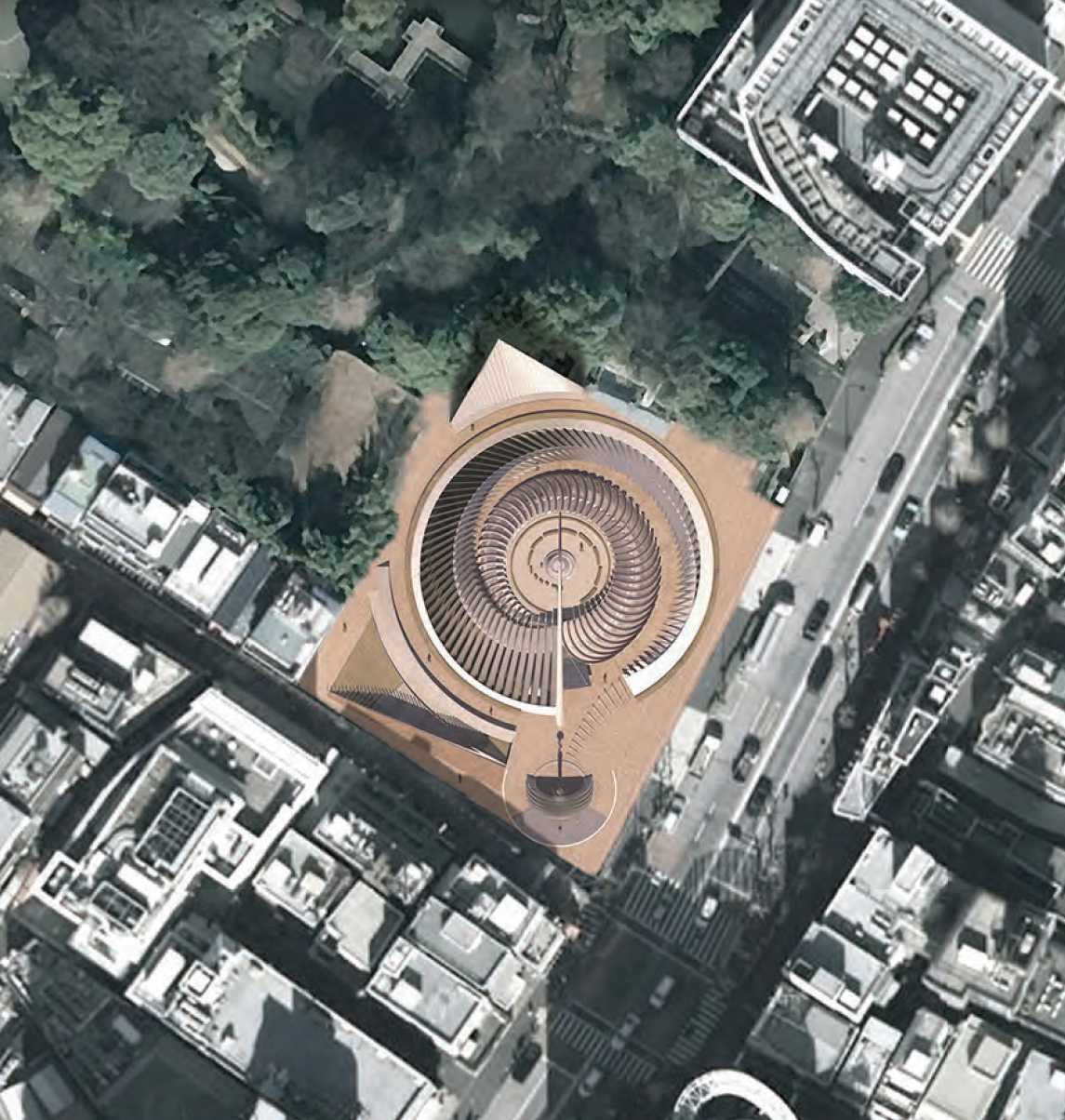
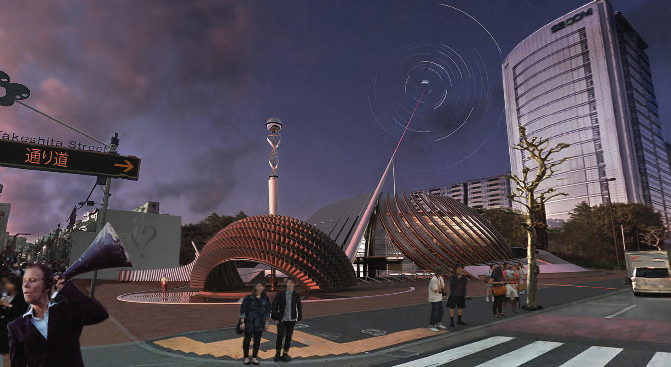
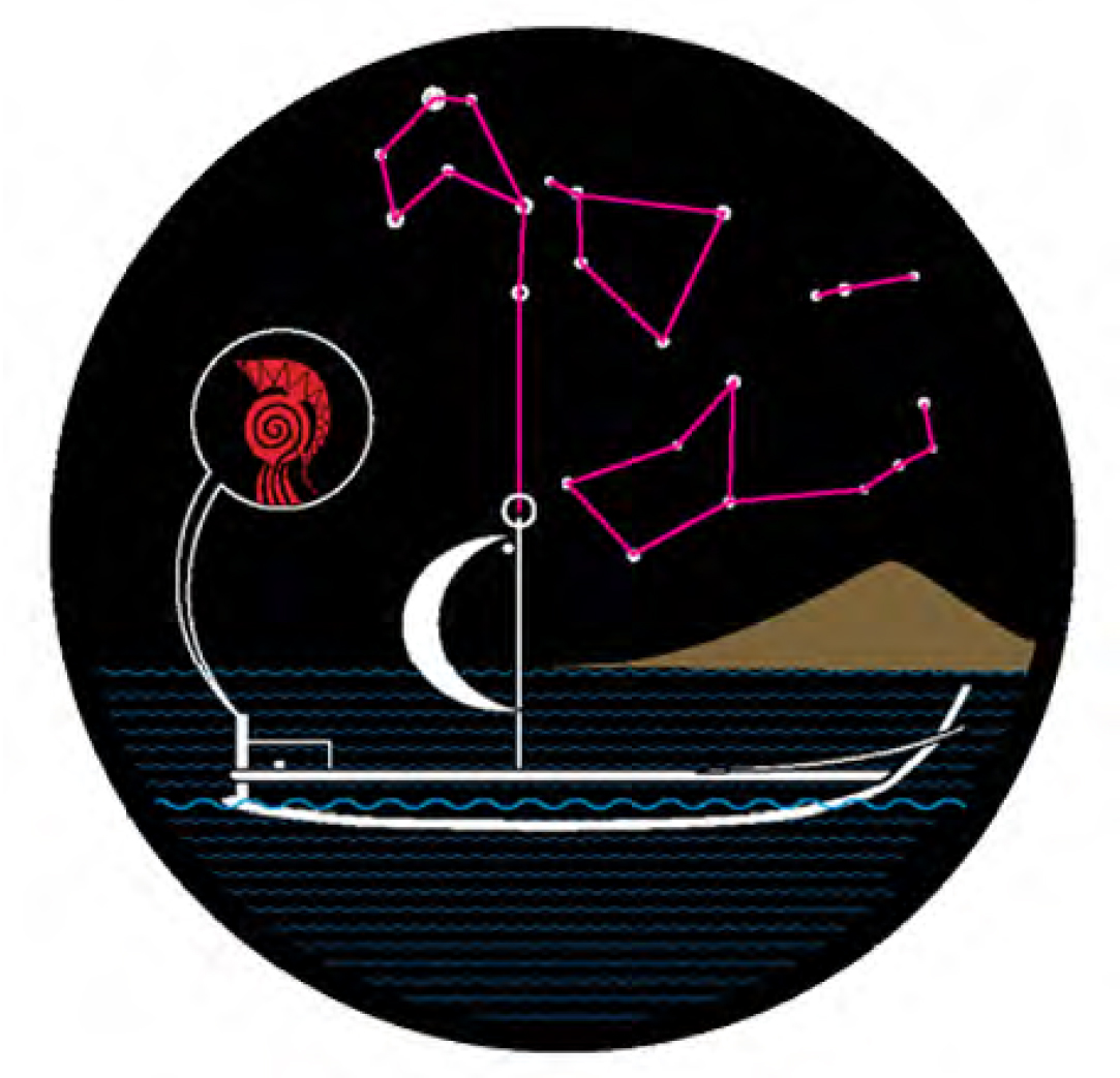
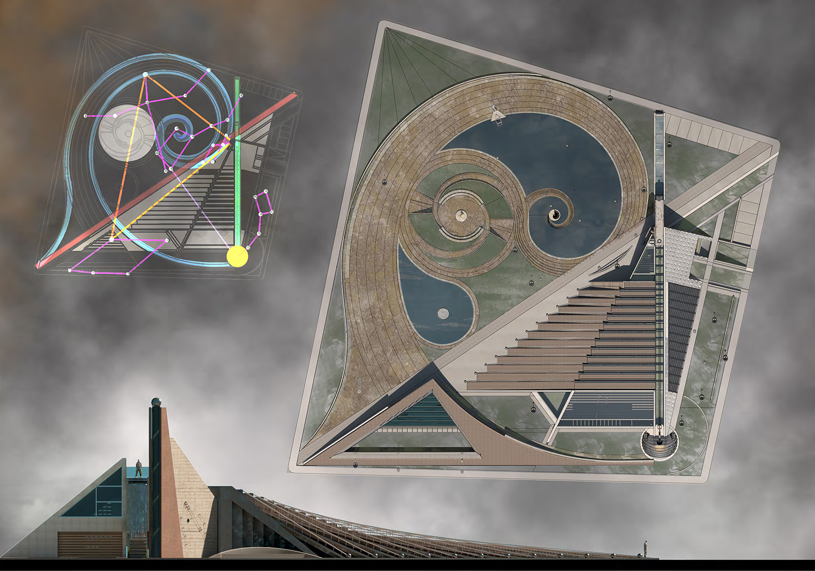
The North-South direction The "Golden" Spiral The Constellations |
     |
 |
|
|
|
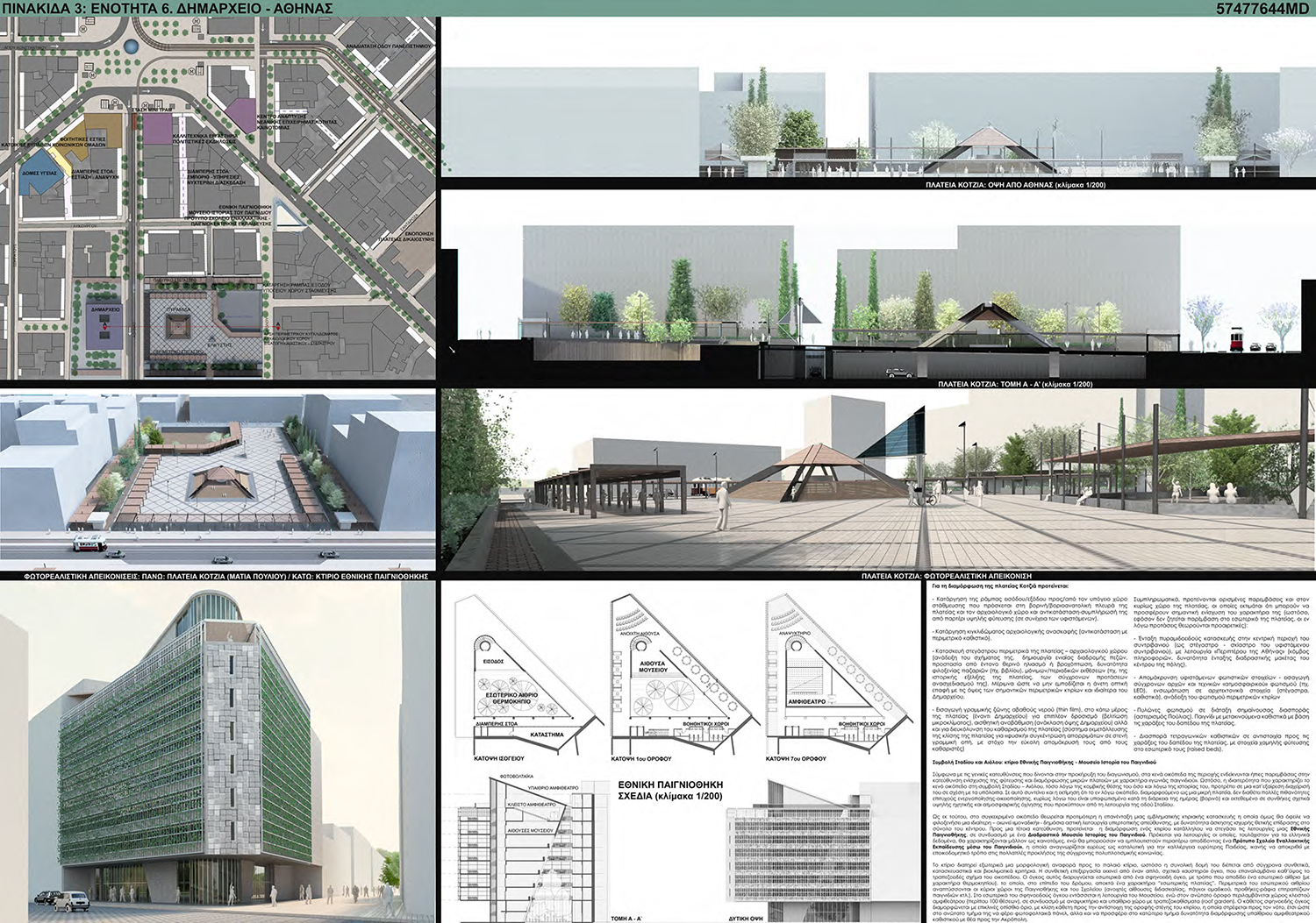
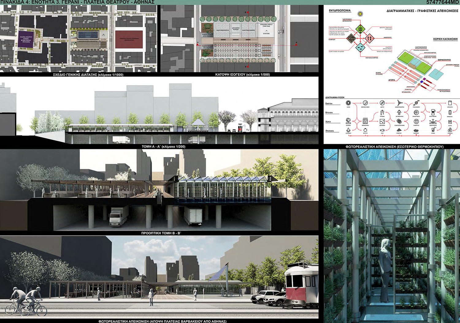
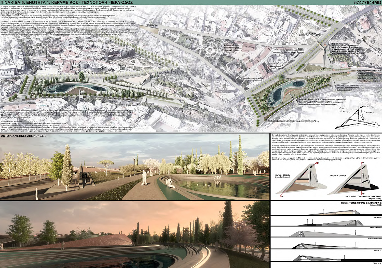
Summary A) Kotzia square, Municipality Athens: mild interventions are proposed in Kotzia square, such as the removal of the perimetric railing of the archaeological site and its replacement with a sitting-shelter, construction of simple sunshades around the sides of the square, rearrangement of elements of equipment, kiosks etc. On the empty plot at the junction of Aiolou & Stadiou street, we proposed the integration of an emblematic building structure with the function of a National “Gameteque”, i.e. an Interactive Museum of the History of Play&Games, which could result in a Model School of Alternative, Game-centered Education. B) Gerani - Theater Square: we propose the demolition of the elevated structure in Varvakeios Square and its redesign, with the aim of forming a direct functional and visual connection to Theater Square, along with the concentration of open-air food market functions and the liberation of the sides from car lanes, for the connection with the side buildings and the development of tall trees. In addition, a special function of a productive-botanical garden inside a greenhouse with translucent photovoltaic canopies is proposed, for the implementation of a model system of Vertical Aquaculture, in a maze layout, to maximize the functional surface and conduct a complex educational quest-inquiry adventure game! C) Kerameikos - Technopolis - Iera Odos (Holy Road): we propose the demolition of the old train station warehouses and its replacement with a modern “landscape” building construction, as an extension of the surrounding squares-parks, with a parallel provision of extensive interior space, suitable for the inclusion of a Museum of the History of Architecture. In addition, we proposed to remodel the park in the area of the former Korean Market, with the aim of unifying and functionally enriching it, through the formation of a water landscape of lakes - natural pools, suitable for swimming (during summer) or an alternative use of a skateboard park. The configuration also results in an important water reservoir, capable of contributing to the prevention of flooding in the wider area (connection with the stream of Iridanos). |
    |
 |
|
|
|
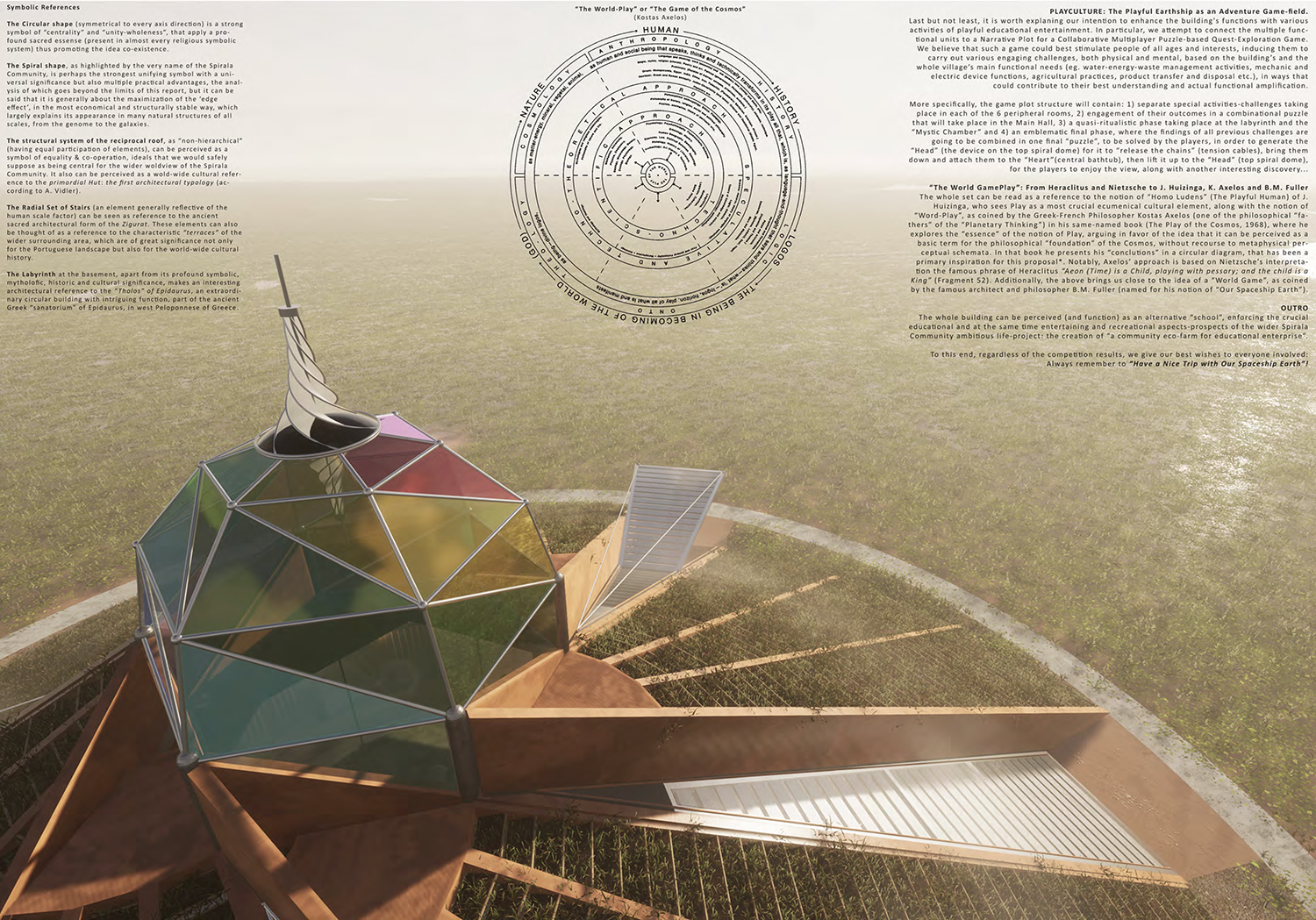
General Synthetic Principles 13 The concept of "Gamification" describes the process of integrating various spatio-temporal elements of any function and scale into an interactive condition (digital and non-digital) that utilizes the mechanics of various types of games, with the main goal of mobilizing the active participation of people in various activities , capable of unfolding in parallel or even in association with the conventional functions of a spatial field. The specific designation of gamification as "ecosophical" refers to the concept of ecosophia as defined by Felix Guattari as "an ethical-political articulation between Environmental, Social General interventions Beyond rendering a particularly extensive surface of public space accessible to pedestrians and people with disabilities , Model system of ecological management of urban waste It is also proposed to utilize the tram line for the implementation of a standard system of ecological management (recycling and composting) of inorganic and organic waste. |
   |
 |
|
|
|
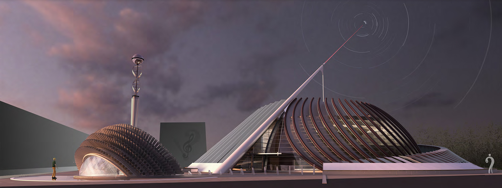
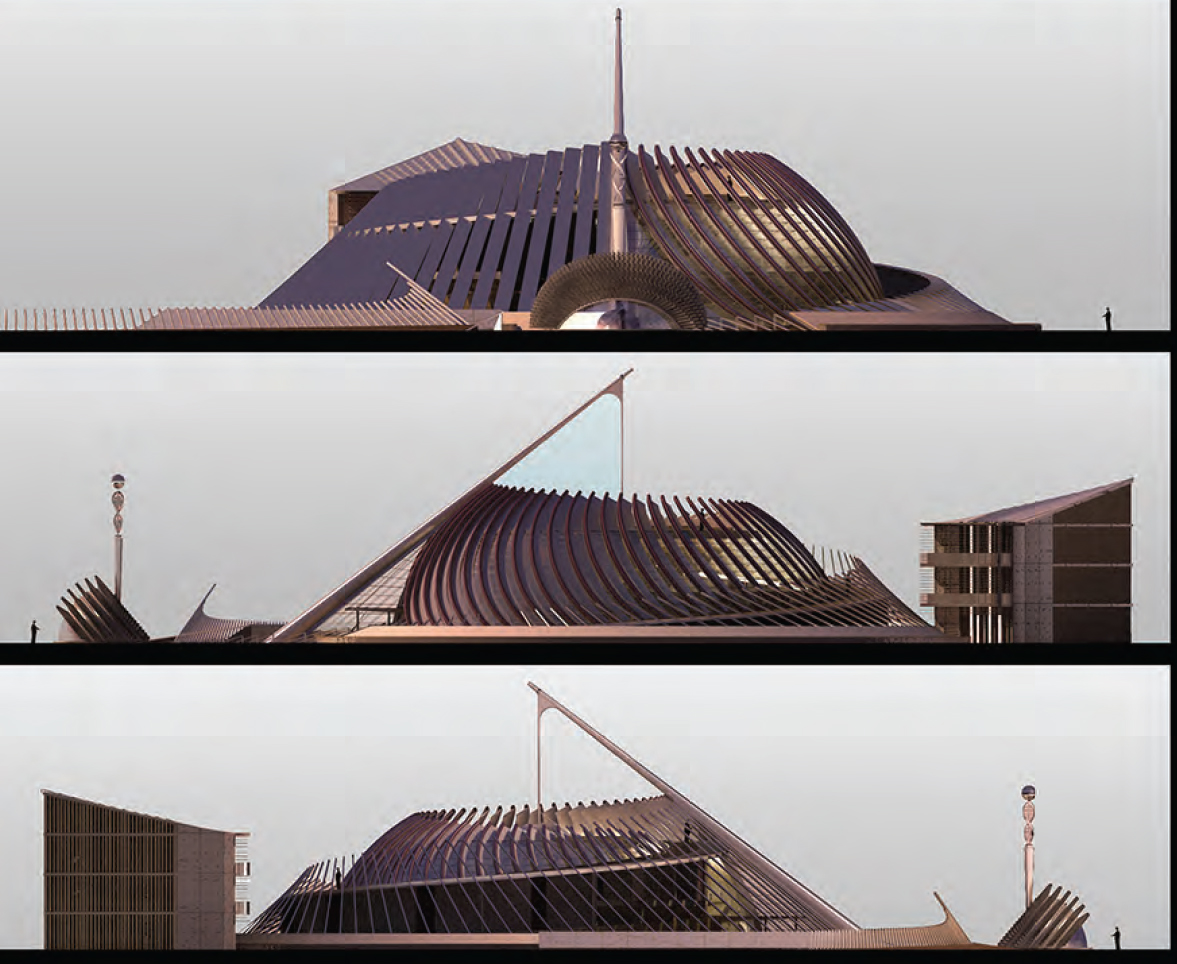
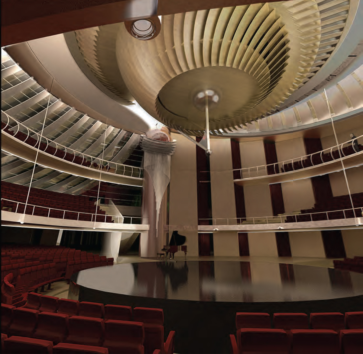
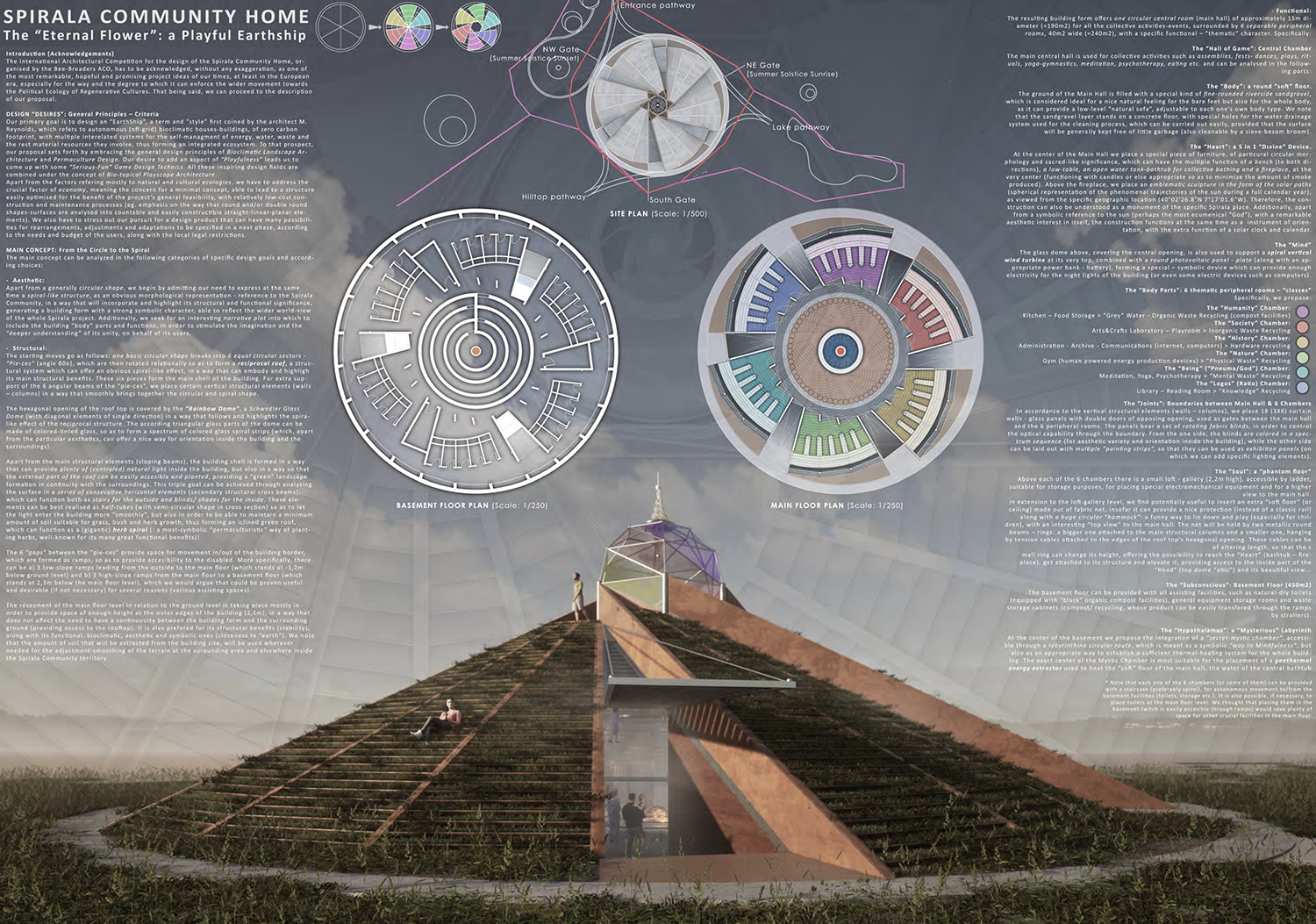
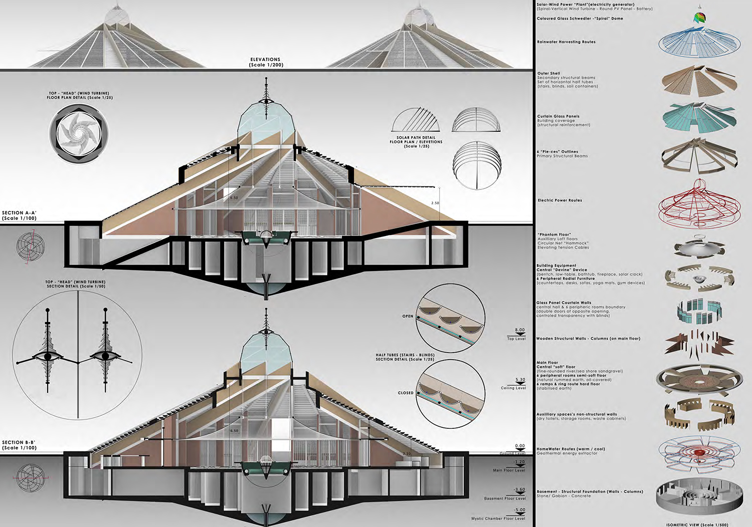
General Principles - Criteria Central Idea: From the Circle to the Spiral |
    |